A major roads scheme at the Friary Road junction in Armagh could be at risk of surface water flooding from a centuries old underground river, Armagh I can reveal.
Rivers Agency has sounded the warning to Planning Service as an application is currently being considered for an £800,000 junction improvement scheme which is aimed to tackle traffic congestion in the area.
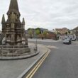
The application has been presented to Armagh City and District Council as part of the statutory consultation process.
Armagh I first revealed the specific plans for the development which, DRD told us, would involve the proposed improvement of the Newry Road/Friary Road, Scotch Street junction, through a “significant upgrade of the existing traffic signal controlled junction”.
It would result in two lanes of through traffic in each direction, plus right turning lanes on the main Friary Road into Newry Road and a new access to Scotch Street.
In addition, there would be left slip lanes into and out of the Newry Road junction.
It would, a DRD spokesperson explained, allow two lanes of traffic to exit the Newry Road and provide a new access road into the city centre. This new access road would connect into Dobbin Street, at a mini roundabout, which “will better control traffic movements in this area”.
With the application currently under consideration, officials from the Northern Ireland Environment Agency and Rivers Agency have been contacted for their views.
The NIEA has replied to DoE Planning Service and does not have any objections to the plan, stating by letter: “We are satisfied that all proposed engineering works are at a sufficient distance from any listed building so as not to require an engineering method statement.”
The Rivers Agency does not have any specific objections either.
It states that, while it does not lie within a flood plain, the site is affected by “an urban watercourse”, known as the Dirty River.
The Agency, in a letter to the planning authority, says it has “no specific reason to object to the proposed development from a drainage or flood risk perspective”.
But it warns that, at the site “there may be a risk of surface water flooding” which could be a “potential problem”.
The Rivers Agency advises that the applicants, in this case DRD Roads Service’s Southern Division, must “satisfy themselves that they have assessed the flood risk and can mitigate the risk to their development and others”.
They add: “They should appoint a competent professional to assess the flood risk and drainage impact.”
The Dirty River is an underground watercourse which begins a few miles on the outskirts of Armagh.
It was known as the Scotch Street river during the 1700s but later acquired the more vulgar ‘Dirty River’ as it once served as the city sewer.
It the early part of the last century work was carried out to lead and direct most of the watercourse through pipes as the city grew in size.
And yet sometimes, during the course of heavy rainfall, the system was unable to control it and the water rose above ground, the run-off leading to flooding, mostly notably on the Mall. The most famous example and often recalled was in the late 1950s, when it was under several feet of run-off water, pictures of which exist showing boats actually being paddled on the Mall.
The issue of flooding, therefore, will be required to be looked at as part of the overall development.
The work in the area of the Newry Road was to be carried out at the same time as a major sewer network scheme, the first phase of which will begin shortly around Lonsdale Road.
It is expected that the Newry Road junction scheme, which would take three months to complete, will be given permission to proceed shortly. With the necessary issues addressed and consent to proceed, work would get underway in January.
The overall scheme, through the construction of a mini roundabout at the bottom of Scotch Street, would also lead to the loss of 70 car parking spaces at Friary Road.
But as we revealed in August, a central bay of car parking, consisting of some 30 spaces and two disabled spaces, will be located in the raised central reservation directly in front of Johnstons Bakery, to curtail the impact.
Read more news:
Emersons Supermarket bar/restaurant proposal wins planning permisison
Costa Coffee approved for Spires retail park in Armagh
Minister approves closure of Clintyclay Primary at end of school year
Sinn Fein announce Catherine Seeley as Upper Bann Westminster candidate
Dogs Trust microchippers returning two months after stone throwing attack
Calls for Georgian Day to be extended to benefit Eurospar centre traders
Beautiful heron crane blasted with gun and has its neck pulled
Armagh actor Colin Morgan signs up for new eight-part TV series Humans
Gold mining company to extend operations from Keady to Clontibret