Two days of heavy snow, sleet and icy conditions have been forecast with weather warnings updated to include the whole of Northern Ireland.
Warnings will be in place throughout most of this week.
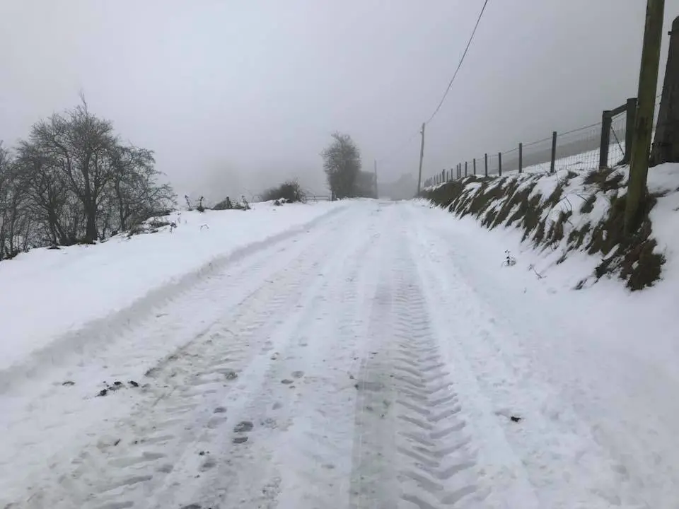
But prolonged and heavy snow is forecast from midnight tonight (Sunday) for the next 48 hours.
And the first half of Wednesday is also expected to bring further snow and icy surfaces.
With Storm Ciara doing her worst warnings are in place throughout today in relation to very strong winds.
There are also reports of thunder and lightning too
It had been hoped winds would ease.
‘Please take care whilst driving.
Tree blocking the road entering Forkhill Forkhill from Mullaghbawn side’
Cllr @mickeylarkin1 pic.twitter.com/xv9GVfdd6E
— NewryArmagh SinnFéin (@newryarmaghsf) February 9, 2020
But fresh and updated warnings – which now include snow and ice – are being extended to include Monday, Tuesday and Wednesday too.
The Met Office says the combination of two days of heavy snow and very strong winds will inevitably lead to disruption, with the potential for power cuts and hazardous driving conditions.
Armagh City, Banbridge and Craigavon Borough Council has said the public are advised to avoid forests and parks due to the risk of falling branches and debris.
And a spokesperson added on Sunday: “There may be disruption to council facilities and services.”
The PSNI is dealing with incidents relating to Storm Ciara and has been advising people only to travel if absolutely necessary.
Among those areas affected are the A1, where the PSNI says there is “standing water on both sides due to the weather conditions”.
“There has already been two collisions,” a PSNI spokesperson said. “There will be intermittent land closures to facilitate recovery.”
Good job Armagh played ladt night holy god the weather is kat pic.twitter.com/8YKpdazsTk
— Damian McCullough (@d_mc_cullough) February 9, 2020
The Department of Infrastructure says multi-agency partners met earlier today as preparations continue ahead of forecast severe weather and Storm Ciara this weekend and new warnings into early next week.
Staff from all agencies are on the ground monitoring the situation and will be ready to respond to any impacts.
Traffic disruption and some localised flooding are possible and the public are being asked to consider their journeys and take extra care when travelling this weekend, given the likelihood of strong winds and heavy rain.
The Department’s roads and rivers teams have been checking and clearing road gullies and drainage grills and staff will be on standby.
Monitoring of water levels and tides has been ongoing and will continue until all of the weather warnings have elapsed.
‘Regional Community Resilience Groups’ have also been advised of weather patterns and to make appropriate preparations.
A DofI spokesperson said:”It may be necessary to close roads or put temporary restrictions in place. Road users are reminded to adhere to road signs and any temporary traffic lights.
“If your journey is essential, reduce your speed, stay well behind the vehicle in front, remain focused and always wear your seatbelt.
“Agencies will continue to monitor the situation closely over the week and take any necessary action.
“To report incidents of flooding, please contact the flooding incident line on 0300 2000 100. Calls taken by the incident line staff are passed to the relevant responding Agency.”
|
|
|
|
|||